Welcome to Gurla Mandata
Mt.Everest Expedition (8848.86m)
Mt.Everest Expedition (8848.86m). First of all, imagine yourself standing at the top of the world and watching the whole world below you. That feeling is something unbeatable and also probably one of the best feelings that you can get. This is also possible if you are interested and able to do this Expedition. Therefore, the most popular choice among the mountaineers for Mt. Everest expedition is via the South Col, Because it gives the most assured means of reaching the top.
Mt.Everest Expedition (8848.86m). And also the time spent over 8000 m is less in the approach to the summit on the south side as the summit is attempted in one push. Furthermore, the south route has a good record of success due to the easy access of the route. Finally, once it is opened by the first summiters of the season the admired Everest expedition trail is followed to reach the base camp for the Mt Everest expedition.,
-
Camp 1: 20000ft. (6400m)
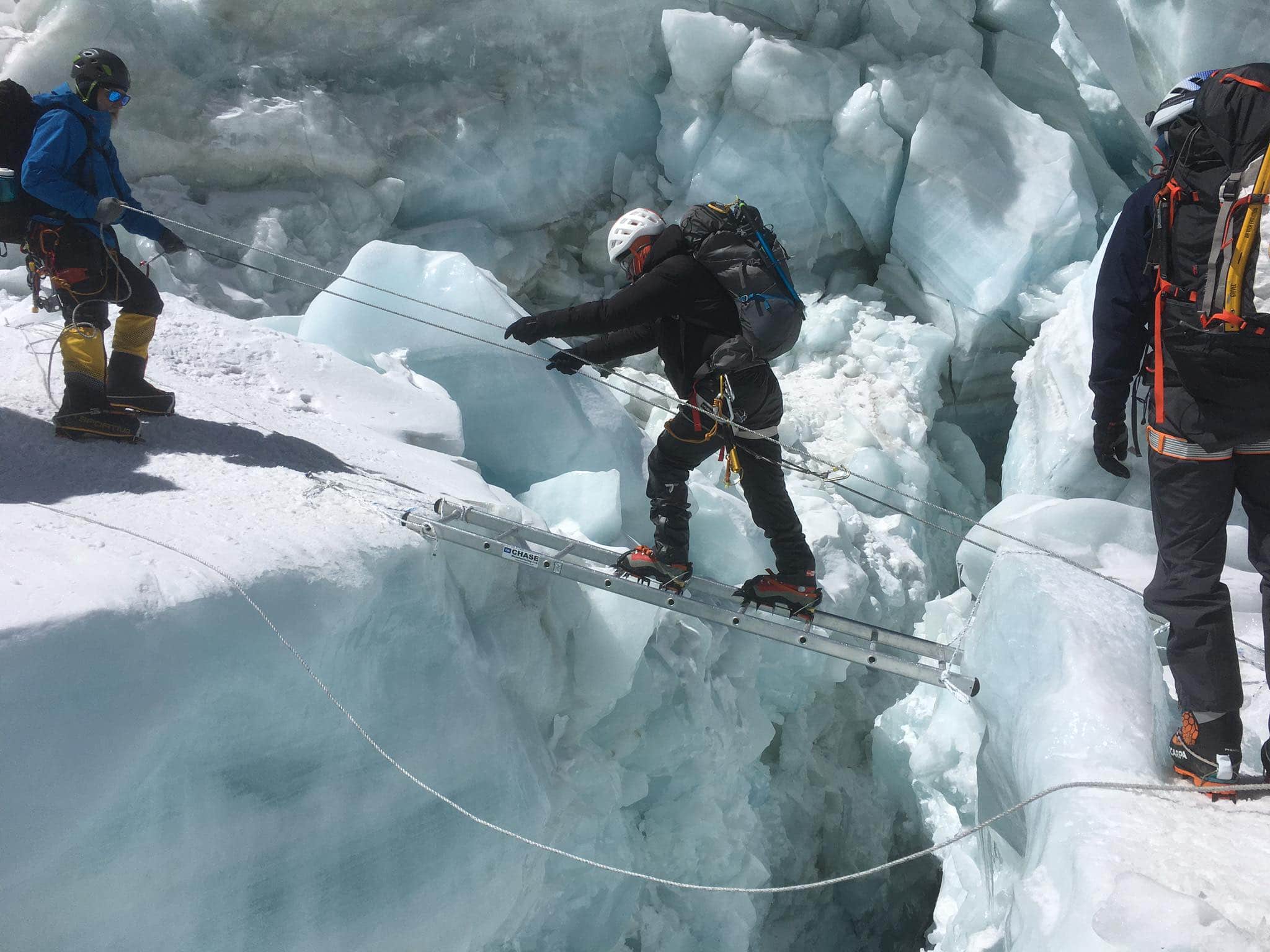
- Camp 1 is situated in a flat area of endless snow deep crevasses and mountain walls.
- Because of the Sun’s reflection from this place we get warm and heating ambience at this place.
- In the night we listen the deep murmuring cracking sounds of crevasses beneath our tent.
- These are the areas where we have to walk to reach camp 2.
-
Camp 2. 21000 ft. (6750m)
- Camp 2 is situated at the height of the 21000 ft, which is located at the foot of the icy mount Lhotse wall though where we have to go ahead.
- Weather is here is good but bad clouds roll in from the low range of the Himalayan valleys to the bottom of our camp two.
- But wind here sometimes seems very violent enough to destroy our tents.
- After climbing these palaces we reach camp 3.
-
Camp 3. 22300 ft. (7100 m)
- Camp 3 is located at the height of 22300 ft, adjoining to mount Lhotse wall.
- After climbing the 4000 ft.
- Lhotse wall by using fixed rope and with prior acclimatization it leads us to camp 4.
- Also, on the way we have to ascend the steep allow bands (lose, down -slopping and rotten limestone).
- From their crossing short snowfield the route moves ahead up the Geneva Spur to the east before finishing the flats of the south col.
- (Another wells name meaning Saddle of pass).
- Oxygen should probably be used above base camp 3 in case of need to the climbers.
-
Camp 4. (7,906 m (25,938 ft)
- Now we are at camp 4 which located at the height of (25,938 ft) .
- It is the last camp of the Expedition.
- From here summit is about 942 m, distance far.
- This is the final and dangerous part of the climbing.
- This place is besieged by ferocious and violent winds.
- Finally, the normal best way to reach the summit is via the narrow South – East Ridge and it precedes the South Summits 28710 ft. From here the way is easy to reach at the summit of the Everest 29028 ft; and late Sir Edmund Hillary and l Tenzing Norge Sherpa used this route in 1953.
SAFETY KITS:
1. Never trek alone. So, hire a guide if you can’t find companion.
2. Choose trekking companies/guides with eco friendly concepts.
3. Become informed about high altitude sickness.
4. Also, carry a good medicine kit.
5. Watch when you are walking. And don’t step backward blindly while taking photo.
6. Therefore, time your trek generously. Moreover, taking rest while trekking is not a sign of weakness.
In addition, trip cost will vary depending on the group size, duration of days and services required. Therefore, please contact us via our email: gurlamandatatrek@yahoo.com with your Details to obtain a Quote.


